About the images: Illustrative scenes accompany this personal story. AI-created images are identified in their captions; they are not photographs of the encounters described.
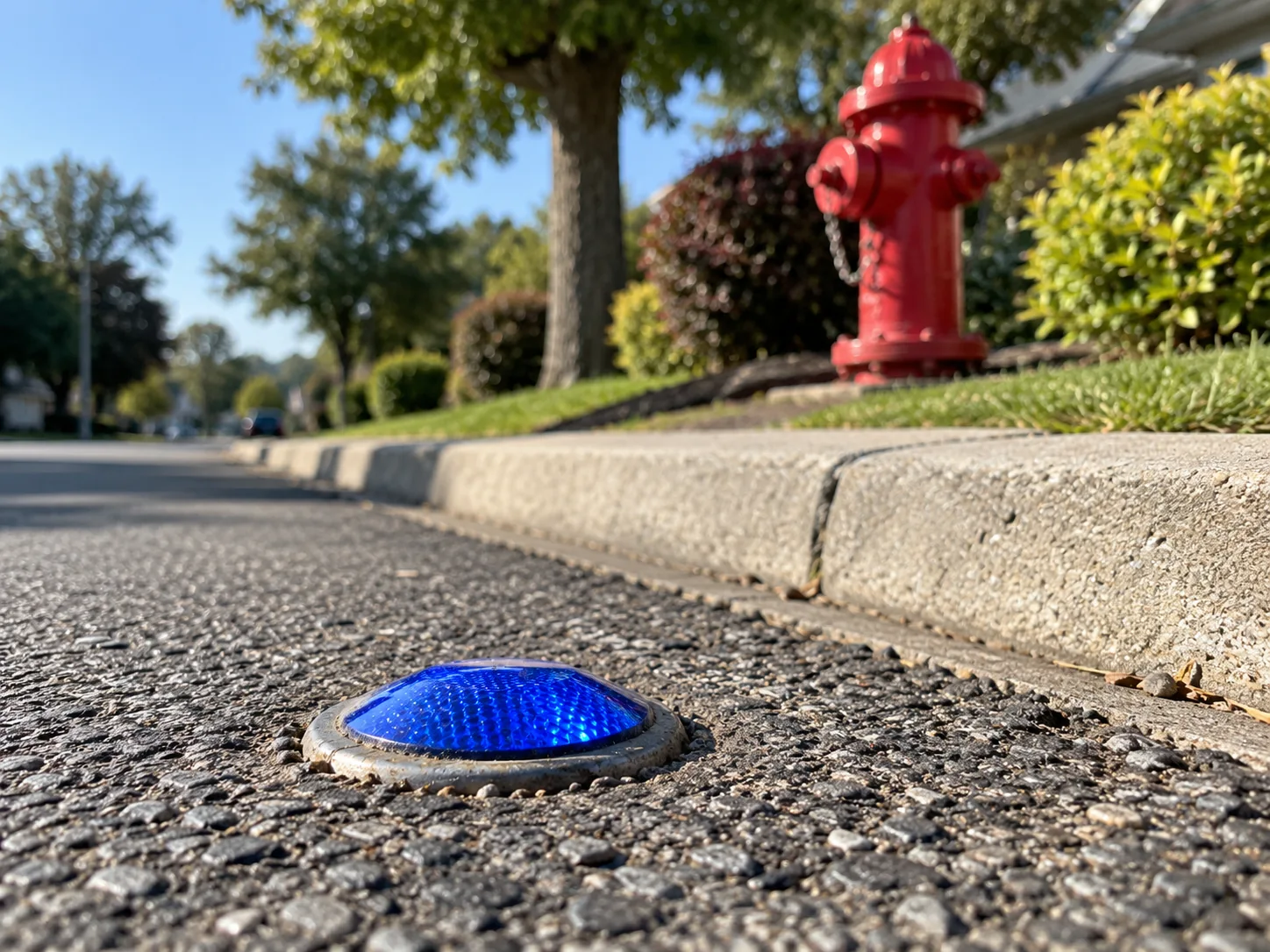
Have you ever noticed those little blue reflectors embedded in the middle of the road?
You’ve probably driven past hundreds of them without giving them much thought.
I always wondered what they were for.
They’re so small, yet somebody went through the trouble of placing them in specific locations. Surely there had to be a reason.
Well, as it turns out, there is. And it’s pretty interesting!
Those little blue reflectors help firefighters locate fire hydrants, especially at night or when visibility is poor.
Think about that for a moment.
Something most of us barely notice can help emergency responders find a water supply when every second counts.
That got me wondering about something else.
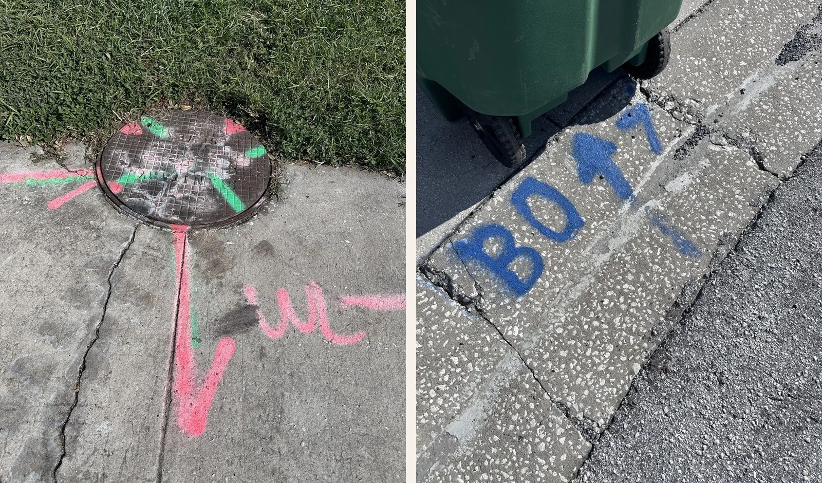
What about all those painted lines, arrows, numbers, metal disks, and strange markings we see on sidewalks and streets?
Who puts them there? What do they mean? And how does everyone know what they’re supposed to be looking at?
I decided to do a little digging.
Not literally, of course. As I discovered, digging in the wrong place can be a very bad idea!
A Language Without Words
Imagine you’re part of a construction crew preparing to dig beside a busy street.
Somewhere beneath your feet could be electrical cables, natural gas lines, water pipes, sewer systems, and communication cables.
You can’t see any of them.
And the people who originally installed those utilities might have been there decades ago.
So how do you know where it’s safe to dig?
One part of the answer is a system of colorful markings.
In North America, underground utility locators use a standardized color code to help identify different types of facilities.
And once you learn a few of the colors, those seemingly random lines begin to make a lot more sense.
Red generally means electrical power.
Yellow identifies gas, oil, steam, or other hazardous materials.
Orange indicates communications lines, including telephone and fiber-optic cables.
Blue represents drinking water.
Green identifies sewers and drains.
Purple is used for reclaimed water and certain irrigation facilities.
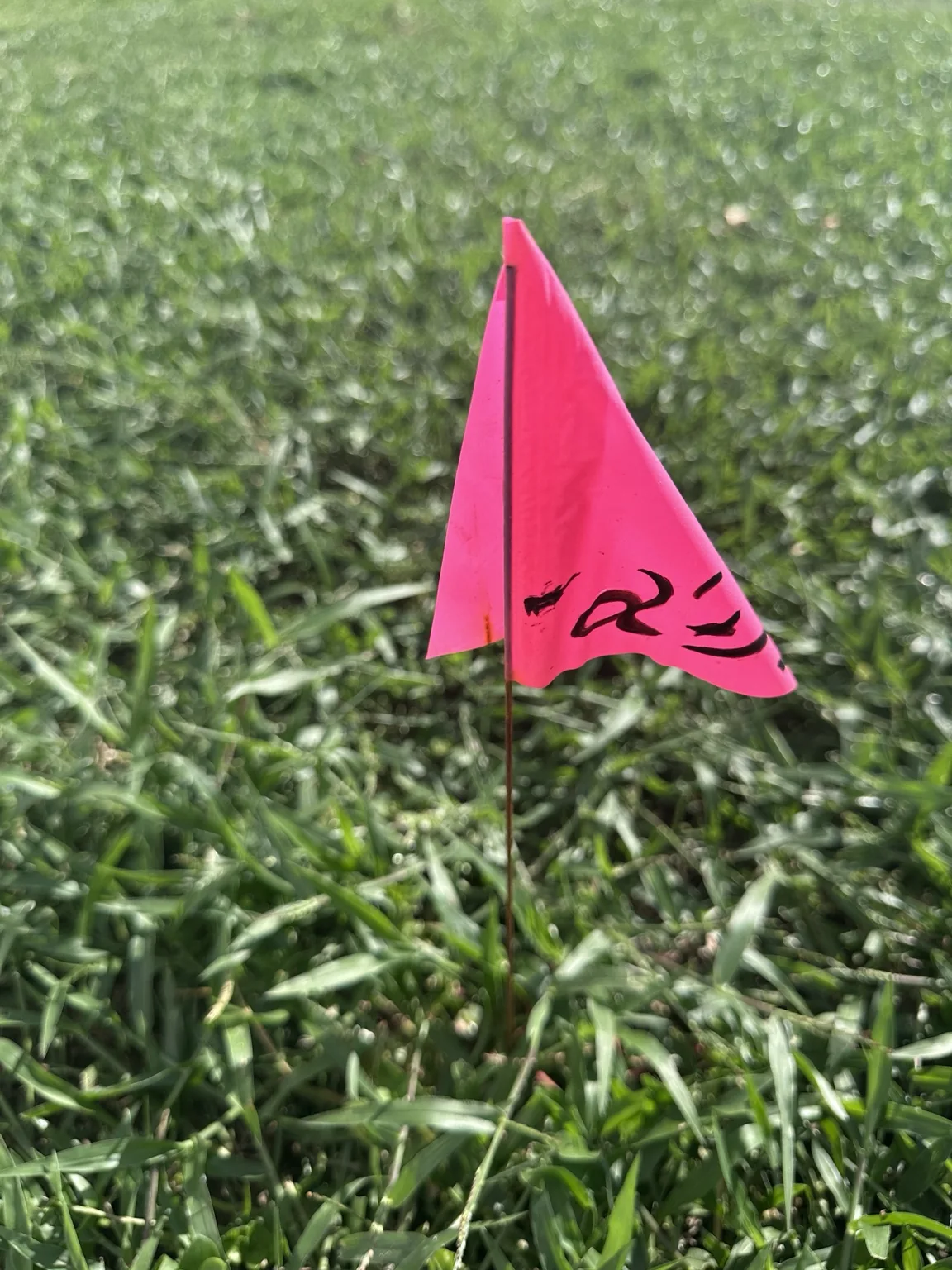
White marks proposed excavation areas, while pink is used for temporary survey markings.
Suddenly, those colorful lines scattered across the pavement don’t seem quite so mysterious!
But here’s something important I learned: the markings show approximate locations, not necessarily the exact position or depth of a buried line.
Before excavation, workers must follow applicable notification and safety procedures. In the United States, that usually begins with contacting 811 so underground utilities can be located.
It’s a clever communication system, but it isn’t a guarantee that digging is safe.
Who Invented the Code?
This was one of the questions I found most interesting.
How did we go from people burying pipes and cables underground to having an organized system that different workers and companies could understand?
As towns grew into cities, the space beneath streets became increasingly crowded.
Water systems expanded. Gas lighting and later natural gas became common. Electrical and telephone networks spread through neighborhoods.
Eventually, digging into the ground meant risking damage to something you couldn’t even see.
Over time, utility companies, public works organizations, and construction professionals developed more consistent ways to identify buried infrastructure.
The American Public Works Association helped establish the uniform color code widely used for temporary utility markings today.
But there’s an important distinction.
There isn’t one universal code for every symbol on every sidewalk.
Different markings have different jobs. Utility paint, traffic markers, survey monuments, and construction stamps belong to different systems.
Some are standardized across large regions. Others depend on local rules, particular projects, or the organization that placed them.
That makes understanding the markings a little like learning several different languages that happen to share the same pavement.
Little Messages From the Past
Not every sidewalk marking is about what’s underground.
Some are about the people who built what’s above it.
Have you ever noticed a name or date pressed into an old concrete sidewalk?
Those are often contractor stamps.
In many communities, the companies that installed sidewalks left their names, and sometimes the year, in the wet concrete.
Decades later, those impressions can still be there.
I find that fascinating.
Think about how many people may have walked across one of those stamps over the years.
The businesses around it may have changed. Houses may have been remodeled or replaced. Entire neighborhoods may look different.
Yet that little name or date is still sitting there, quietly preserving a piece of local history.
It makes me wonder about the people who poured the concrete.
Who were they? What was the neighborhood like back then? Did they ever imagine someone would still be looking at their work a hundred years later?
Sometimes history isn’t tucked away in a museum.
Sometimes it’s right beneath our shoes.
The Mysterious Metal Disks
Here’s another one I didn’t know much about.
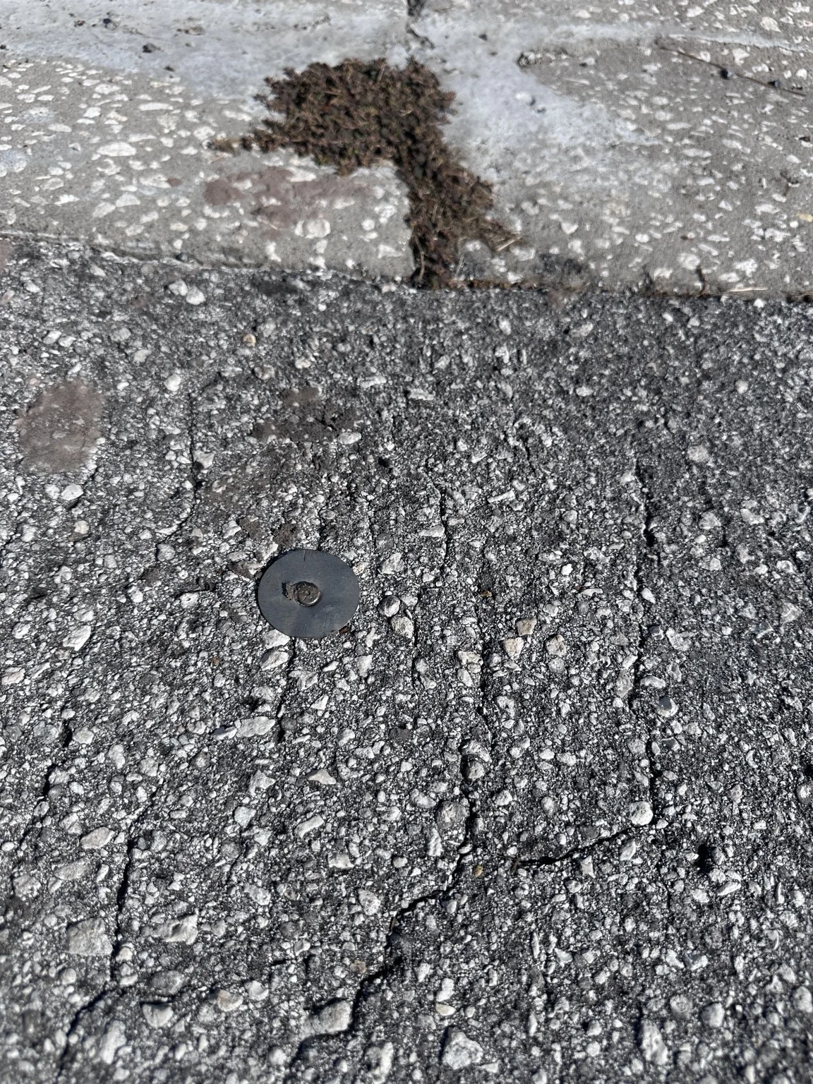
Have you ever seen a small metal disk embedded in a sidewalk, curb, or stone?
Some of these are survey monuments, including benchmarks and other control markers.
They help identify established reference points used in surveying and mapping.
Certain markers are part of networks that have helped surveyors measure elevations and geographic positions for generations.
Some are connected to records maintained by the National Geodetic Survey.
And here’s the part I really like.
You can sometimes look up information about a marker and learn more about its history and location.
Imagine finding a little metal disk during a neighborhood walk and discovering that it belongs to a much larger system of measurements stretching across the country.
That’s a pretty amazing story for something only a few inches across!
Of course, not every metal disk is a survey marker, and not every old marker is still valid for modern measurements.
But that’s part of the fun of investigating.
Back to Those Little Blue Reflectors
Remember the blue reflectors that started this whole discovery?
They’re part of yet another system.
Rather than identifying buried utilities, these raised pavement markers can help indicate the location of a fire hydrant along the roadside.
In places that use this system, blue markers help emergency crews locate hydrants.
Once I learned that, I started looking at those little reflectors differently.
They’re easy to overlook, but they have a very practical job.
And it made me appreciate how much thought goes into things we barely notice.
Somebody had to recognize a problem, develop a solution, establish a way to communicate it, and teach others how to use it.
All so a tiny blue reflector could quietly do its job.
There’s a Story Beneath Every Step
What started with a question about a little blue reflector turned into a fascinating look at the hidden language of our streets.
Some markings help prevent accidents.
Others guide emergency responders.
Some preserve the names of people who worked in our neighborhoods generations ago.
And others connect ordinary sidewalks to the history of surveying and mapping.
I love discoveries like this because they don’t require an expensive trip, special equipment, or a journey to some faraway place.
You can find them almost anywhere.
All you have to do is pay attention.
The next time you’re walking through your neighborhood, take a look at the ground.
You might be surprised by what you discover.
Join the Discovery
Here’s a little challenge for your next walk: Go on a Sidewalk Discovery Hunt!
See how many different markings you can find in your neighborhood.
Look for old contractor stamps, dates pressed into concrete, colorful utility markings, survey disks, or those little blue fire-hydrant reflectors.
Take a photograph of something interesting, and see if you can learn what it means.
You might even discover a piece of local history hiding in plain sight.
I’d love to see what you find!
Share your photographs, discoveries, questions, or stories with Discover the Journey.
Maybe you’ll find a marking we haven’t covered here. Maybe you’ll uncover an interesting story about your neighborhood.
Just remember to explore safely. Stay on public paths and sidewalks, follow traffic rules, and never disturb markers or utility equipment. If you’re planning to dig, follow your local 811 notification requirements.
You don’t have to travel far to have an adventure.
Sometimes the most interesting discoveries are right beneath your feet.
Share your discovery →Behind the Discovery
This article grew out of something I’ve wondered about for years.
I’ve always noticed the strange markings scattered across our sidewalks and roads, especially those little blue reflectors.
I wanted to know what they meant, who decided on the symbols and colors, and whether the people using them followed a common set of rules.
Researching those questions introduced me to the history of utility markings, construction stamps, surveying, and roadway safety.
What surprised me most was how much information can be communicated through something as simple as a painted line, a metal disk, or a tiny reflector.
And it reminded me of one of my favorite things about discovering the world around us.
There’s almost always more to the story than what we see at first glance.
What did you discover today?
Discover the Journey.